Our
House : Latest
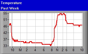
Area Data Monthly
Temp Wind
Month Forecast IWindSurf Detailed
Data Daily
Data Mesonet Tides Temp Neuse
River Tides & Temperature Neuse
Yacht Racing Association Fairfield
Harbour Yacht Club Fairfield
Harbour Fishing Club Blackbeard
Sailing Club Laser Marine
Forecast WX1 USA Details Daily iPhone NSSL
Best
Weather Links
Weather
Forecast Model for 16 Days
?Snow
or ?Rain Best link Minnesott
Water Temp Area
Temps/Winds/Precip Map
Forecasts: WeatherUnderground NWS
TWC Unisys International NOAA
IWIN TWC
Hourly Intellicast WeatherX
WeatherPoint Marine
(sound) Ocean WITN WCTI
NWS Cape
Lookout NC
Forecast CoastWeather Craven
Airport COAMPS
Model GFS
Model NoGaps
Model
Radars: ENC
Radar Satellite
& Radar Clouds
Clouds2 1/2Hr
Radar Loop 1
Hr Radar Loop 1Hr
Rain 1
Hr Loop #2 1
Hr Loop #3 2Hr
Radar Loop 6Hr
Radar Loop Raleigh
Radar Satellite
& Radar Loop Satellite
Loop Enhanced
Loop US
Radar Satellite
Loop Lightning
1Hr Storm
Movement
Hurricanes: National
Hurricane Center Tropical
Weather Tropical Outlook Hurricane
Alley Atlantic
12Hr Loop NOAA FSU Palm
Beach Post U.
Wisconsin Navy InstaWeather Unisys AtlanticTropical Oceans
Storms Waves Wind
Analysis Satellite
Images Hurricane
Satellites Crown
Weather WeatherUnderground
Blog QuickSCAT Navy
Models: NoGaps2 Other
Models 10
Day Model Multi-Models Surf Surf
2 Waves
(WNA click on animation) Hurricane
Sea Surface Winds
Maps: GOES
Satellites Whole Coast Wind
Map Wave
Height Tide
Charts OceanWeather Current
Weather Fronts World
Waves Stars/Planets Oceans
Storms Loop Wind
Analyses Visible
Winds Wind
Patterns
Neuse: Swift
Creek DENR
Fish Kill Data Monitoring ModMon
Other: SeaSurfaceTemps Surface
Temps2 NOAA
Photos Navy
Ocean Weather Gulf
Stream Gulf
Stream2 GS3 GS4 IWindSurf Conversions/Calculations
Webcams: Emerald
Island Atlantic
Beach ABLiveSurf Sheraton Indian
Beach Beaches NC
WRAL Others Oceans2 Ocracoke Ocracoke2 Oriental Nags
Head Hatteras Duck Duck2 Wrightsville The
Gorge 1, 2 Kanaha
Beach Park, Maui
6
Hours 48Hours
Latest
Hurricane Information
Latest
Hurricane Information
Sale
Today
Tomorrow
Forecast
for next 16 Days
DC
Mr.
Brown Poem
Osprey
Fishing